
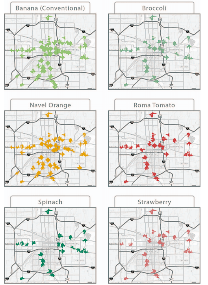
This image shows maps of pedestrian access to six different produce items in Lansing, Michigan.
It is from the following article: Goldsberry, Kirk, Chris S. Duvall, Philip H. Howard & Joshua E. Stevens. 2010. Visualizing Nutritional Terrain: A Geospatial Analysis of Pedestrian Produce Accessibility in Lansing, Michigan, USA. Geocarto International, 25(6), 485-499. [pdf].
I worked with colleagues Chris Duvall and Kirk Goldsberry to examine retail food access in this metropolitan area from 2008 to 2011. Chris and Kirk were formerly in the department of geography at Michigan State University – Chris is now at the University of New Mexico, and Kirk is basketball analytics coordinator for the NBA’s San Antonio Spurs.
We were motivated by the simplistic approaches taken by many researchers in this field before this time. One example was the common practice of defining food access as the presence or absence of a supermarket, without considering what foods are sold at other retailers. Our approach was to inventory every retailer that sold fresh produce, and record every variety (along with every variety of refrigerated soft drinks), and analyze their spatial distribution. The paper below describes some of our additional findings:
Duvall, Chris S., Philip H. Howard & Kirk Goldsberry. 2010. Apples and Oranges? Classifying Food Retailers in a Midwestern US City Based on the Availability of Fresh Produce. Journal of Hunger and Environmental Nutrition, 5(4), 526-541. [pdf].
Kirk and Sarah Acmoody wrote a short outreach article on this project in Fall 2010, which can be found at http://www.esri.com/news/arcuser/1010/foodesert.html. It was also covered by a number of media outlets, including an article in American Scientist (May-June 2011).
Kirk posted numerous additional maps and interactive slideshows on his university website, but unfortunately these small images at archive.org are all that are now available:

https://web.archive.org/web/20120508063111/http://geo.msu.edu:80/food/media/
